Author Archives: metaforms07

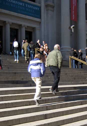
Stairs at Metropolitan Museum

Location : 1000 5th Ave, New York, NY

map_met.jpg


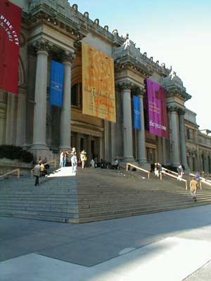
The Metropolitan Museum of Art first opened on February 20, 1872, housed in a building located at 681 Fifth Avenue in New York City. John Taylor Johnston, a railroad executive whose personal art collection seeded the museum, served as its first President, and the publisher George Palmer Putnam came on board as its founding Superintendent. Under their guidance, the Met’s holdings, initially consisting of a Roman stone sarcophagus and 174 mostly European paintings, quickly outgrew the available space. In 1873, occasioned by the Met’s purchase of the Cesnola Collection of Cypriot antiquities, the museum decamped from Fifth Avenue and took up residence at the Douglas Mansion on West 14th Street. However, these new accommodations were temporary; after negotiations with the city of New York, the Met acquired land on the east side of Central Park, where it built its permanent home, a red-brick Gothic Revival stone “mausoleum” designed by American architects Calvert Vaux and Jacob Wrey Mould. The Met has remained in this location ever since, and the original structure is still part of its current building. A host of additions over the years, including the distinctive Beaux-Arts facade, designed by Richard Morris Hunt and completed in 1926, have continued to expand the museum’s physical structure. As of 2006, the Met measures almost a quarter mile long and occupies more than two million square feet, more than 20 times the size of the original 1880 building.

Architecture : original architects of the Museum

Calvert Vaux and Jacob Wrey Mold designed the Museum’s first permanent home in Central Park—a red-brick neo-Gothic structure. The original facade was in the Gothic Revival Style in 1880. The present facade and entrance were completed in 1926. Part of the original facade can be viewed from the Robert Lehman Wing looking toward the European Sculpture and Decorative Arts galleries.

met_01.jpg


met_02.jpg


met_03.jpg

met_04.jpg


Riverside Park Pier I

Location : 70th Street At the Hudson River

map_pier1.jpg

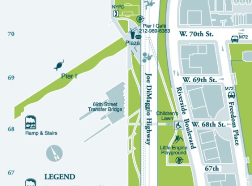
Pier I and most of Riverside Park South were originally part of the abandoned Penn Central railyard between 59th and 72nd Streets. Reconstructed to its original length of 795 feet, the pier has been narrowed considerably and is now only about 55 feet at its widest part where it once was wide enough to fit four parallel railroad tracks.

pier_01.jpg

In April 2001, Phase I of Riverside Park South, a 7-acre section from 72nd to 68th Street was officially opened to the public. One of the most unique features of this first section of the new park is the recreational pier. Most piers are built perpendicular to the shore, but Pier I, along with its old neighbors Piers B, D, E, F and G as well as the nearby gantry, were built at a 55-degree angle to the shore to facilitate the transfer of rail cars from their tracks to a waiting barge. Only pilings remain of Piers B, D, E, F and G, but the ninety-five year old gantry remains standing today.

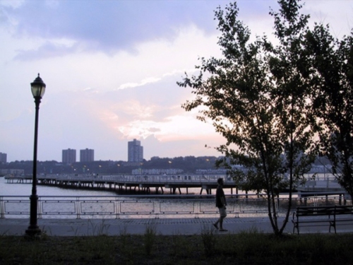
Although Pier I is no longer used for its original industrial purpose, it does continue to serve the community well. Park users can now fish off the pier, or just sit and enjoy the river views. The pier also plays host to many events and activities in warmer weather. In the summer, you can watch movies under the stars, and in the fall, you can bring the family to Riverside Park South’s annual West Side County Fair.

pier_02.jpg

pier_05.jpg

pier_03.jpg

pier_04.jpg


Intersection of model agencies in SoHo


<map of intersection of model agencies in SOHO: a pin is the intersection and marks are model agencies found by googling “model agency nyc”>
Model Agency NYC around SOHO : http://tinyurl.com/3yttam

Initial Idea:
There are a flow of models at the intersection.

History:
http://en.wikipedia.org/wiki/SoHo

What became SoHo was to have been the locale of two enormous elevated highways, comprising the two branches of the Lower Manhattan Expressway. The highway was intended to create an automobile and truck through-route connecting the Manhattan and Williamsburg Bridges on the east with the Holland Tunnel on the west.

The young historic preservation movement and architectural critics, stung by the destruction of the original Pennsylvania Station and the threat to other historic structures, challenged the plans because of the threatened loss of a huge quantity of 19th century cast-iron structures, which were not then highly valued by the general public or contemporary business community. When John V. Lindsay became mayor of New York City in 1966, his initial reaction was to try to push the expressways through with political spin, dubbing the Robert Moses project the Lower Manhattan Expressway (or Lomex), depressing some of the proposed highway in residential areas and stressing the importance of the artery to the city. Nevertheless, through the efforts of Jane Jacobs, George Maciunas and other local leaders, the project was derailed and abandoned.

After abandonment of the highway scheme, the city was still left with a large number of historic buildings that were unattractive for the kinds of manufacturing and commerce that survived in the city in the 1970s. Many of these buildings, especially the upper stories which became known as lofts, attracted artists who valued the spaces for their large areas, large windows admitting natural light and cheap rents. Most of these spaces were also used illegally as living space, being neither zoned nor equipped for residential use; yet, this zoning violation was ignored for a long period of time as occupants using space that would have most likely been dormant or abandoned as a result of the poor economy in New York City during that time.

Pictures:

<flow of models at the intersection>

<a building of a model agency>


<street in SoHo>


<street in SoHo>


<a model of a model agency>


<a building and a doorman of a model agency>


<intersection of B’way and Prince Street, known as the intersection of model agency or Armani Exchange corner>

Videos:

<short video of the intersection>

http://www.youtube.com/watch?v=xFGBwzLILso

http://www.youtube.com/watch?v=3xGumaqcblI

Dog Run at Washington Square Park


<Dog Run at Washington Square Park. Blue mark>
<West 4th Street and MacDougal New York, NY>

Initial Idea:
Dog run. One of very strange scenery for me. An enjoyable chance to see various dogs.

History:
Built in the 1820’s on the site of a former potter’s field and then public gallows, the Washington Square Park went through a series of redesigns and additions to achieve its current, well-known state. Initially, the park was a cemetery for yellow fever victims in the late 1700s; in its next incarnation, the park was a parade ground and a site for public hangings. In the latter part of the 19th century, it became a desirable residential area for the upper classes gradually moving uptown (as exemplified by Henry James’ Washington Square), escaping the disease and congestion caused by the advent of immigrants to downtown New York. Surrounding the park today are original rows of red brick, high-stooped houses that have been preserved as historic landmarks, and now serve as NYU administrative offices.

Pictures:


<dogs at dog run>

<financed soley by dog run user donations>

<only dogs and owners>

<small dog run for small dogs>

Links:
Washington Square Park at Wikipedia
Washington Square Park at PPS.org
Photographs from NYC Dept. of Parks & Recreation
HOW TO ESTABLISH A SUCCESSFUL DOG RUN IN YOUR COMMUNITY
= Benefits, Recommended Rules, etc.
Tompkins Square Park, First Run
= First Run was the very first dog run established in Manhattan. It was established by the community and is still fully maintained and supported through civic and corporate donations. — Posted by First Run
History of 72nd street Dog Run

Expanding Chinatown


<map of chinatown. from: http://www.explorechinatown.com/ >

Initial Idea:
(First of all, none of our group members is Chinese.) The Chinatown is expanding. As seen in a neighborhood map of NYC, Chinatown isn’t an official district. However, it is very easy to feel China on the Canal street. It seems about to intrude to Little Italy or Financial District. What makes the expansion? What makes the invisible boundary of Chinatown?

History of Chinatown: excerpted from explore chinatown

1846    Chinese junk, Kee Ying, sails into New York Harbor from Canton with a crew of 35. During the summer, a reported 50,000 New Yorkers visit the Kee Ying.

1878     First Chinese grocery store, Wo Kee, opens on Mott Street. U.S. Supreme Court denies Chinese the right to become American citizens.

1902    Chinese become the first nationality to be denied free immigration.

1965    Racial quotas system for immigration is abolished.

1968    Beginning of new influx of Chinese immigrants and expansion of New York Chinatown.

1980    U.S. census indicates that New York Chinatown is the largest Chinese American settlement in U.S.

Pictures:


<boundary of chinatown. Canal street>


<Church street at Canal st.>


<Chinese Sign on Canal st.>


<both of Chinese and English sign>